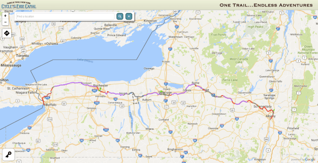
The Erie Canal Towpath is the land’s second longest continuous bicycle path—or rather, it would be if it were considered to be a single trail, which it sort of is anyway.

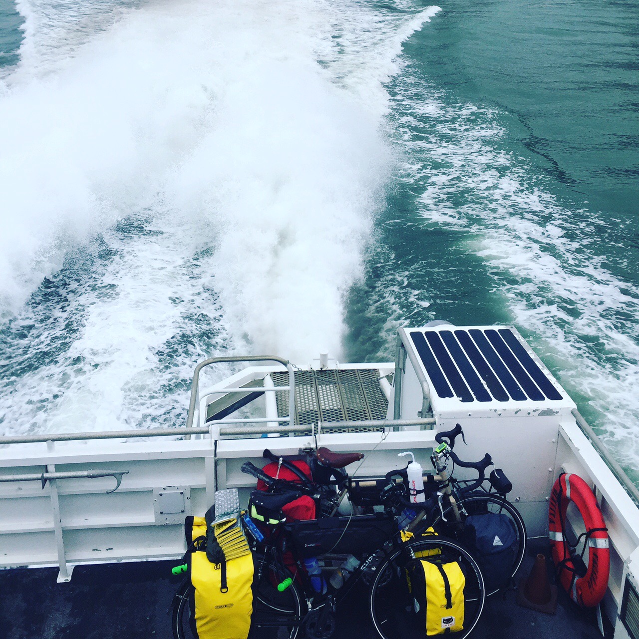
Rami and I somewhere.
The path links Buffalo in the west to Albany in the east and comprises a network of dedicated paths, local park trails, some city streets, and under 50 miles of state road shoulders. The trail goes for about 360 miles and passes through virtually every kind of terrain Western and Upstate New York have to offer (mountains excepted). Riding the Erie is rather more of an adventure than taking on the C&O/GAP but it is by no means too much to take tackle and it really is worth it—it is a great ride.

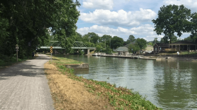
A typical view along the active portion of the Erie Canal–this one near Fort Plain, NY.
Our trip was in July and while it was warm, we never hit high heat and we avoided rain—we were lucky. We were two riders: me on my 2009 Surly LHT with a Brooks B17, Surly front rack and Topeak Tourist rear rack carrying a set of Ortlieb front and back rollers, and a Chrome roll up seat post bag for tools. My 15-year-old son Rami on a 2010 Surly Cross Check (my commuter with no front brazeons) with a Brooks B17, Bontrager rear rack carrying two Axiom Seymore Panniers, and a large Axiom seatpost bag filled with Hammer gells. We both carried Revelate Tangle top tube bags as well. These were genius—the best thing I have added to my kit in a while. They were easily accessible and super handy carryalls. They were never in the way (except maybe when it came to putting the bikes on the car) and were easy access bike handy wallets.

My Surly LHT loaded and leaning on a tree. The shot shows the Revelate Tackle bag in its natural habitat. Great addition to the kit.
One thing to know before you get one (as well you should): the large size is deeper than the medium and small and so it intrudes more into the space one usually reserves for water bottles.
We covered the whole distance in 6 riding days (we took a 0 mile day in there) meaning an average mileage of about 63 miles per day. Our biggest day was 86 miles but I do not recall the shortest. Subtracting our biggest day creates an average mileage of 58 per day for the remaining 5 and that seems about right. I should add that no day felt really challenging—even with the hills and roads. We stopped to smell the roses and took breaks for worthwhile sites—in short, it was far from grueling, and if our mileage was low some days it was because we were pleasantly diverted. Nevertheless, I want to head back up and try it again and shoot for finishing in 4 days this next time—anyone with me?
When I was planning this trip I found less info online and in discussion forums about the Erie than other rides, and so my goal here is to fill in some holes and provide some of the info I would like to have known before I set out. The main source of information I turned to was the website run by Parks and Trails New York (PTNY) which is the body that oversees and promotes the trail. They manage that very helpful website, organize a large group ride in July, promote the trail, and are working to secure more sections.
The PTNY map works well on a smart phone and they have made a little icon that links you right to it as if it were a stand alone app. The colors of the trail’s run in the map indicate road surface and were very accurate. Find the map at this link
I relied on their website quite a bit during the ride—particularly the interactive map they provide. That map carries current information about closures and route changes and has a handy mileage calculator that lets you plot out a trail section’s distance with a reasonable degree of precision. The calculator though can only do straight lines, so some of the curves become a bit more square in your calculations.

This is a section of the PTNY map on my phone showing the milage counter against the color-coded map.
Nevertheless–super helpful. There also is an independently published book or two available that has some pretty nice section maps. I did not have the PTNY book when I set out, but I grabbed a copy along the way and found it helpful but not essential.
Despite the great trail and amenities, there is not a fully developed culture of through travel on the Erie, so most of the info in books and sites is targeted at people planning short rides and looking to do their rides in maximum comfort. Much of the material out there stresses the trails’ doability and the path’s unquestionable beauty and history. It seems targeted at those considering a ride who may not have tried one yet and need some reassurances about the value of the trip and trail. No knock on any of that intended at all, but long distance riders’ questions often get deep into the weeds and I found it hard to get from the web the kind of brass tacks answers I most wanted. Where can you camp? What grades are the hills? How available is water, how far between supply points and so on—I found it hard to get these important questions answered in advance. So, here we go.
First thing to know is that there are really three Erie Canals—and the path does bits of each. The first is the original canal completed in the 1820s.

This is a typical section of the now-disused 1820s-1860s canal somewhere near Syracuse. On the left is a standard section of double track and on the right is the glint of some over grown canal ditch and water. Some of these sections had HUGE carp in them, so if you like fishing this is your place! On the whole though, you would be forgiven for thinking this was the C&O in Maryland.
The second is an expansion of that original system in the 1860s that left bits of the original rare things indeed. The third was a further expansion in the early 20th century that swallowed up the 1860s canal in some places and created a whole new route in others. You need to know this because the trail touches parts of all three and each presents different challenges and advantages.
Here is a view of what much of the trail looks like between Lockport and Rochester. Fine crushed stone, wide path, and an active waterway are constant companions. It was no effort at all to stay above 15mph fully loaded on these stretches, there also were lots of towns and resources along the way.
On top of that, there are seasonal boaters using the active canal and info for them abounds. But—their route is slightly different than the one cyclists ride in some areas—so use the boat info carefully. What all of this means is that sometimes you are riding along side of a wide and usable canal and passing by modern operating locks—each of which is state owned and a legal camping spot–while other times you will be riding next to an overgrown and forgotten ditch—much like riding the C&O—with few amenities and only stealth camping if needed. Knowing that in advance makes it a lot easier to plan things out.
The operating locks are numbered and all have well manicured lawns. A few have bike lock racks and picnic tables. An even fewer have unlocked Portasans. There is very little visible notice that camping is permitted—but it is, so just set up and settle in.

This was our camp at the lock at Marcy, NY. This was the largest and most fully equipped lock campsite we saw, but I am sure there are others. This one is right on the path (seen at left) and coming upon it at about 5pm made it just too inviting to pass up. This was still during the early Pokemon rush and poke trainers were strolling all over.
It is probably a good idea to lock up (no pun intended) since more than a few of the locks are fairly close to civilization and its occasional sticky fingers. With that said though, we had no trouble at all and in fact loved chatting with the lock master at Marcy New York and watching the boating action in the morning. The lock by Schoharie Creek near Fonda New York though was a bit off the trail and had nothing to offer other than a great lawn and a big shade tree. But—having the run of the place and a long sunset was great. One of the staff had left a nice pair of field glasses on a table next to the main building and that made for fun viewing up and down the Mohawk. On top of that, an open maintenance shed had outlets where we could recharge. We even considered sleeping in the shed, but there was no threat of rain. Lacking any way to say thanks though, I swept out the shed so at least the floor was nice and clean the next day.
Many of the towns—particularly west of Rochester and just to its east along the active canal—also allow free camping in public places for cyclists. Again, there is no public posted notice of this, so you may have to ask to make sure. The best example was Brockport where we spent a 0-mile day wandering in town and meeting people.

Our camp at the Brockport Visitor Center. We locked the bikes to the tree over there and ate at the table on the other side. It was a wonderful comfortable camp.
As with the GAP, some towns have embraced the canal and others not so much so. Brockport is one of the best examples of a place taking the trail to heart. There is a nice visitor center right on the canal which welcomes both cyclists and boaters (smart move since both parties have wallets). The wonderful volunteers showed us where to camp right on the lawn and gave us the pass card that granted us access to a big clean bathroom with a shower and outlets.

The bathroom at the Brockport Visitor Center
All we had to do was stop by the police and let them know we were there (they were nonplussed) and we were set for two nights at no cost. The visitor center also has a nice sitting room and we spent time there chatting with the volunteers and other guests. We were the only cyclists, but there were a few boaters tied off at the dock. It was nothing to walk over to the main strip in town where there was a bike shop, food supplies, and tons of people chasing pokemon. Oddly, few of the in-town business owners knew that cyclists were allowed to camp at the visitor center—and in fact we only ended up there because a sudden late day rain just after a coffee stop in town had us sheltering in the Brockport Fire Department. It was the firemen who directed us to the visitor center—so now I pass on their advice. Brockport is a must stay when you ride the trail.
Hotels are all over the place on the trail, but there are no real hostels we could find, so if you plan on staying under a roof each night, plan on shelling out between $75 and $100 for the privilege. PTNY’s web site has a list of hotels and other amenities which is worth the look over. It could be a bit better though if it also said just how far from the trail was each hotel. It is one thing to see that the town ahead of you has 6 hotels listed. It is quite another to discover that they are 4 miles away, uphill, and on an un-shouldered state highway. More details about the viability of hotels would have been good to know. Even so, we avoid hotels as much as possible to save money—maybe doing one hotel night to three or four tent nights ideally when touring. For that reason discovering the free camping in towns and at locks was a blessing.
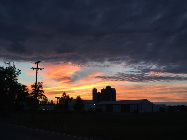
The sun going down just west of Montezuma on State Road 373. This is at the top of Cayuga Lake amidst lots of Amish farms.
We also stayed at a commercial campground at the Montezuma swamp near Clyde, NY at the top of Cayuga Lake. Although on roads, the passage on the trail here was lovely and full of fun hills and Amish farms. We cruised through this terrain as the sun was getting very low and just loved it—no cars at all, just us, the road, and the occasional Amish buggy.
The disused sections of the canal—mainly the miles east of Clyde, NY—are very different than the heavily trafficked western sections. This is where road shoulders become more a part of a cyclist’s day and the condition of the canal trail is far worse than the western miles of very solid crushed stone.

The Erie is great for your cycling tan.
Riding here was often very much like riding the C&O in Maryland: a swampy overgrown canal trench on the right and single or double track dirt-in-grass paths to your front. Lots of road crossing here as well and towns were thick on the ground. That meant that we never worried for water even though it would have been hard to find a good camping spot if it came to it. It was no effort at all to maintain 15mph or more on the crushed stone but road speed dropped significantly on the older canal sections—13mph was good, but ruts and puddles often slowed us down to 11mph. Another irritation here was that many sections of the trail had patches of loose crushed gravel filling in potholes and water damage.

It does not look like much, but this hill was one of two that I had to dismount for. In this case it was due to loose gravel that bogged my tires. This patch was somewhere near Jordan, NY.
These were rarely for any distance, but they came on us suddenly and sometimes threated to cause real trouble if we hit them at speed. A little bogging and fishtailing was the worst we got and neither of us went over the handlebars as I had worried. Nevertheless, I got a few good heart stops as I hit these patches. One rise to a road crossing was so loose that I could not gear down in time and was reduced to a full stop as my wheels sunk in and I had to unclip and walk a few steps (only one of two times in 400 miles, so that is not so bad).
The diversity of trail conditions makes tire choice and interesting problem. What with covering everything from to loose pack to ice-smooth tarmac, getting the right tires is as important as it is impossible. I had arranged for our support team to meet us at each crucial junction with a change of tires—road worthy 25mms for the paved sections, light tread 32mms for the hard packed crushed stone, and nubbly 40mms for the rougher areas. But back in the real world where there is no such thing as our support team, I had to make a single call at the start and trust to luck.

Sometimes there is work going on which shuts down the trail and it makes more sense to push through rather than take a two mile on-road detour. This was outside Rochester.
Since we were doing the Erie right after covering the C&O/GAP the tires had to do multiple terrains over close to 800 miles. I went with 32mm Continental Touring Plus run up to 80-100psi. These are a bit thinner than the 38mms I used on my last tour and thought were exactly wrong. I wanted the lower rolling resistance of the thinner tire and yet still wanted some beef and tread. They worked fine, but in truth, no tire can be all things. I saw other people with a variety of choices and each had some good and bad to them. I was happy with the Contis though and would happily use them again. They were good all arounders but it all depends on what you want. Some riders clearly prefer the cushion and bite of a thicker tire with low PSI. I on the other hand hate pinch flats as much as I hate anything in life, and would rather take some knocks than replace inner tubes. I also want to be able to get up to the mid- 20mphs the second the trail lets me (pushing 40mph on some of my favorite down hills)—but obviously not everyone wants that. If you want to get speed you need to have the tires that agree with you on that project. One complaint about the Contis was that the rear tire on the Cross Check was oddly worn when we were done—more than the other tires despite not bearing a heavier load and enduring the same conditions and psi. I am not really sure what was up there and it may simply have been a bad tire. My next tour is going to be either 1000 miles or 3000 so I may move over to Schwalbes then. We’ll see.
Signage on the Erie is a mixed bag even though the trail managers have done a good job over all of getting a fairly uniform marking system in place. Admittedly, on large sections of the trail there is no need for signs: the choices are pretty simple—either I ride on this crushed stone ribbon, or I can turn left and slam into that cornfield or I can turn right and plunge into the canal.

That circle shield is the most common trail sign. Note the color of the arrow–whether sun faded or a curious choice, the arrow can be hard to see when you are at speed, unsure where you are, and wary of cars.
No sign needed for much of the trail–especially west of Rochester. But it gets a bit trickier when passing though towns and riding state roads. Here the right and left turns are easy to miss at your cost. We were very lucky to be following the big annual July ride which left behind its spray painted marks on the pavement—little red hobo signs that helped us (and the 700 some odd riders the week before) keep on track. This is where the Erie is more like traditional bike touring and less like the C&O/GAP—you have to know where you are and are going. Even so though, clearly the goal is to increase the number of riders on the trail and some better signage would help sooth nerves. A problem though is that the many municipalities along the way will have something to say about signs and that can be just too much for advocates to take on. So for that reason, uniformity would help. There is a basic trail logo and it is on any of the signs. There are often helpfully posted at directional changes accompanied by an arrow. But in many cases the arrows were hard to read white on tan and sun faded. Since there are often cars around and signs pass by in an instant while riding, I found that we had to stop at many signs to be sure. That is not a really big deal, but I think it is a good thing to know about as you prepare a trip of your own.
Be prepared to be a bit confused in cities too while hostile cars whiz by. The issue was most pronounced passing through Syracuse and on the approach to Albany from Schenectady.

Riding in Buffalo will take some concentration.
This section of the trail links together lots of local dedicated bike paths to mixed effect. A few turns are a bit sudden and unforeseen as you charge ahead eager to make the much-awaited destination. On top of that, this is the hilliest stretch of the trail. That is no big deal—but there are a lot of ups and downs—few being more than a 5% grade. There is one killer hill though just east of Schenectady in the Niskayuna area. That one is big enough to have its own warning signs. The worst part of the hills though was that more than a few of the down hills—especially in Colonie—end at stop signs and traffic or sudden tight right turns. That means riding your breaks hard right when you should be enjoying withdrawing your deposit in the gravity bank.

Intersection near Albany
Beware too that things get pretty weird in Cahoes (in many ways). There is a very sudden left onto a city street that we overshot and I gather others did as well since the local bike path just carries on happy as a paved clam. Working back through hilly Cahoes was not fun to begin with, and then finding and navigating the road bridge in town was no picnic either as we were there close to 5pm and traffic was thick. I would say that this was the single most challenging urban riding we did—and that includes the whole of Syracuse (the largest urban stretch) which all in all was pretty straight forward. The long on-street ride on Broadway through Watervliet is worth careful attention too.

The trail as it passes through Green Island. NY outside Albany
The streets here are numbered, but there is a sudden 3rd Avenue thrown in just to confuse your counting—when you see 3rd Avenue, the turn on 4th St is still a ways away. This is just the sort of place where a good sign could make a big difference—and given the traffic issues, confusion can become an issue of safety.
Another useful thing to have in advance are the mileages between towns, crossings, and waypoints. This bit of vital trip planning intelligence was also hard to come by—but knowing distances is essential to planning out how long you think it will take to get from point A to point B. The published guidebooks have mileage tables, but these are hidden in the back and are a bit spare anyway—and of course, are not available online. I kept a record for myself using my Cat Eye and I am sharing my results here. There is some imprecision in my miles though. I was not always so careful about clocking the mileage in the same place in each town—some I recorded at the edge of town, others right in the center. Some waypoints were little more than road crossings while others were whole cities, like Syracuse which I only clocked where the trail merges with Rt 173—but when planning your ride keep in mind that Syracuse occupies most of the 12 miles eastward until DeWitt. I also made no record of Colonie, Cahoes, Green Island, and Watervliet but just lumped them into the 32 miles between Schenectady and Albany. In a few places I also had a diversion to a campsite or a resupply a bit off the trail. Rarely were these infrequent jaunts more than a mile or two, but I did not carve those miles out of my totals. So, there is a little imprecision in my table, but it certainly will help you plan out where you might be day to day. As they say, “your mileage may vary,” but not by all that much.

All in all, the Erie is a great bike ride and many many more people need to make it a regular part of their riding. It is a great mix of place, exertion, and adventure and I really hope a more fully developed through ride culture comes into being. It is a great resource and it is calling out for more prominence. Ride it.


Recent Comments